


The Conway School prepares students for professional practice by providing the opportunity to engage with faculty on meaningful, real projects for homeowners, communities, and non-profits.
Students complete three significant projects over three terms, beginning with an individual small-scale project, working up to team projects of larger scale and scope, and graduating with a portfolio of real work.
All projects investigate projected impacts of climate change and how such impacts may disproportionately impact underserved communities. Project fees support the school’s operations.
Three Scales of Student Projects

Small Sites
Fall Term (Sep-Dec)
Designs for small sites including residential properties, small municipal parks, outdoor classrooms for local schools, and conservation areas. The final product is a 20-page illustrated plan set.
Large Sites
Spring Term (Apr-Jun)
Spring projects are plans and designs for large sites such as farms, college campuses, town centers, city parks, extensive conservation areas, and other open spaces. Students gather input from stakeholders and create plan sets with designs.
Planning Scale
Winter Term (Jan-Mar)
Typically at the watershed, municipal, or regional scale, winter projects examine planning-level ecological and social systems and policies. Students conduct public engagement, create analytical maps, and produce detailed reports.

Small-Scale Site Design
Individual students complete site designs in the fall term for properties located in the Hampshire, Hampden, and Franklin Counties of Massachusetts (and occasionally just outside of these counties).
- Residential projects include rural, suburban, and urban properties ranging in scale from 1/4 acre to 10 acres.
- Small-scale non-residential projects include pocket parks, conservation lands, community gardens, schoolyards, green cemeteries, and other landscapes open to visitors.
Community & Ecological Planning Projects
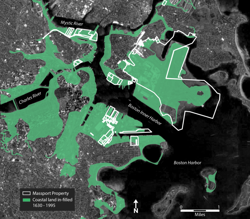
During the winter term, each team of 2-3 students partners with a community client to conduct broad geospatial analyses and to make recommendations across an area such as a watershed, municipality, or region. Students work with community partners across the northeast, including town or city governments, conservation organizations, and other grassroots and non-government organizations. Winter planning projects include facilitation of stakeholder meetings and incorporate topics such as:
- Conservation & biodiversity: Planning for strategic conservation, open space & recreation, supporting pollinators, and promoting ecological resilience.
- Climate resilience: planning for community resilience to extreme weather, green infrastructure improvements, and improving watershed health.
- Transportation, housing, & equitable communities: Planning bicycle networks, walkability, connectivity, sustainable housing growth, community land trust growth, and access to amenities across socioeconomic groups.
- Agricultural systems: Planning to promote greater community access to food and strategic protection of farms & agricultural soils.
- Wetlands & clean water: Planning to increase the health and resilience of wetlands, watersheds, and public water supply lands.

Large-Scale Site Design
During the spring term, each team of 2-3 students is paired with a government or community organization to conduct a comprehensive site analysis and design a landscape plan. Each spring project is for a defined site across the northeast (including parks, conservation areas, campuses, farms, and educational centers); these projects are typically larger and have multiple stakeholders. Spring design projects include facilitation of stakeholder meetings and incorporate assessment and recommendations for:
- Climate resilience: Developing recommendations for land management that can better withstand future climate stressors such as urban heat island effects and heavy rainfall events.
- Wetlands & clean water: Identifying interventions that minimize soil erosion, reduce the movement of contaminants, and promote healthy waters.
- Habitat improvement: Creating planting pallettes & plans that support ecological conditions and client goals.
- Access for all persons: Identifying design opportunities that promote equitable use across all ability levels.
- Recreational amenities: Creating conceptual plans for trail design, parking lots, multi-use paths, play structures, and shade.
- Grading, drainage, and solar exposure: Creating plans that support client goals while incorporating existing site conditions.
- Wayfinding & circulation: Analyzing where, how, and with what cues different users are navigating across the site.
- Agricultural resilience: Developing recommendations that support soil health, agricultural production, diversification, and agritourism goals.
- Site carrying capacity: Assisting clients to identify where to site structures based on the natural conditions of the landscape.